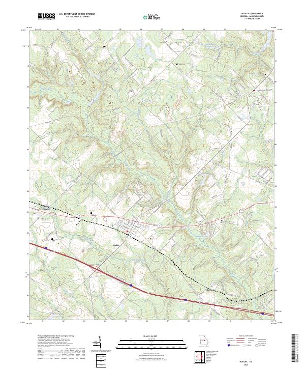
2024 Map of Dudley
USGS Topo · Published 2024About this map
The town of Dudley anchors this portion of Laurens County, showing a transition from the established street grid of the village center to the sprawling agricultural and timber tracts of central Georgia. The landscape is defined by the drainage systems of Turkey Creek and Little Rocky Creek, which feed into several local water bodies including Lord Lake and McLees Lake. The area's long-standing family and community ties are evident in the numerous small burial grounds dispersed throughout the countryside, from Oak Grove Cem in the north to the Heath Wilkenson Cem further south.
Find a feature on this map
111 named features on this map. Tap any name to fly to it.
Don’t see what you’re looking for? This feature index may not catch every label — zoom into the map to look around manually.
Map Details
Editions of this 2024 Dudley Map
This is the sole edition of this map. No revisions or reprints were ever made.
Other maps of this area

1957 · Macon
USGS Topo · 1:250,000

1958 · Macon
USGS Topo · 1:250,000

1964 · Macon
USGS Topo · 1:250,000

1974 · Chester
USGS Topo · 1:24,000

1974 · Cow Hell Swamp
USGS Topo · 1:24,000

1974 · Danville East
USGS Topo · 1:24,000

1974 · Rentz
USGS Topo · 1:24,000

1974 · Dudley
USGS Topo · 1:24,000
1974 · Nicklesville
USGS Topo · 1:24,000
1974 · Stuckey Boone Lake
USGS Topo · 1:24,000