
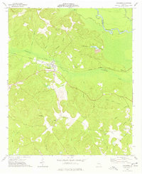
1974 Map of Cow Hell Swamp
USGS Topo · Published 1976About this map
The Oconee River serves as the central artery for this Georgia landscape, defining the boundaries where Wilkinson, Johnson, and Laurens counties meet. The river's winding course is flanked by expansive wetland systems, most notably the descriptive Cow Hell Swamp and Beaverdam Swamp. These bottomlands are dotted with oxbow lakes and cutoffs like Yorks Dead River, Clear Lake, and Jack Lake, illustrating a dynamic fluvial environment where the water constantly reshapes the land.
Find a feature on this map
52 named features on this map. Tap any name to fly to it.
Don’t see what you’re looking for? This feature index may not catch every label — zoom into the map to look around manually.
Map Details
Editions of this 1974 Cow Hell Swamp Map
This is the sole edition of this map. No revisions or reprints were ever made.
Other maps of this area

1916 · Irwinton
USGS Topo · 1:62,500

1920 · Irwinton
USGS Topo · 1:62,500

1957 · Macon
USGS Topo · 1:250,000

1958 · Macon
USGS Topo · 1:250,000

1962 · Oconee
USGS Topo · 1:24,000

1962 · Irwins Crossroads
USGS Topo · 1:24,000

1964 · Macon
USGS Topo · 1:250,000
1973 · Toomsboro
USGS Topo · 1:24,000

1974 · Dudley
USGS Topo · 1:24,000

1974 · East Dublin
USGS Topo · 1:24,000