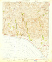
1932 Map of Dume Point
USGS Topo · Published 1932About this map
The Santa Monica Mountains meet the coast in this 1929 survey, revealing a landscape of large family holdings and early commercial outposts along the Pacific Ocean. Before the era of intense residential development, the Malibu shoreline was defined by landmarks like the Malibu Trading Sta and the extensive Rindge Ranch. Inland, the terrain is carved by steep drainages including Trancas Canyon and Dume Canyon, which provided natural routes for early travel.
Find a feature on this map
26 named features on this map. Tap any name to fly to it.
Don’t see what you’re looking for? This feature index may not catch every label — zoom into the map to look around manually.
Map Details
Editions of this 1932 Dume Point Map
2 editions found
Other maps of this area

1900 · Triunfo Pass
USGS Topo · 1:62,500

1903 · Camulos
USGS Topo · 1:125,000

1921 · Triunfo Pass
USGS Topo · 1:62,500

1929 · Dume Point
USGS Topo · 1:24,000

1929 · Vejor
USGS Topo · 1:24,000

1929 · Solstice Canyon
USGS Topo · 1:24,000

1932 · Dume Point
USGS Topo · 1:24,000

1932 · Seminole
USGS Topo · 1:24,000

1932 · Russell Valley
USGS Topo · 1:24,000

1932 · Arroyo Sequit
USGS Topo · 1:24,000
Featured Places
- Malibu, CA
- Unincorporated Santa Monica Mountains, CA
- Trancas, Malibu
- Malibu West, Malibu
- Los Angeles County, CA