
1932 Map of Dume Point
USGS Topo · Published 1932About this map
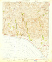
Malibu’s coastal canyons and high ridges appear here during a period of isolated ranching and early motoring before the mid-century development boom. The landscape is defined by the Santa Monica Mountains and a series of steep drainages, including Arroyo Sequit and Trancas Canyon, that descend to the Pacific Ocean. Settlement patterns are dominated by large landholdings and private estates, such as the Rindge Ranch and Kincaid Ranch, alongside smaller mountain homesteads like the Smiley Place. The coastal edge shows the early footprint of the State Highway skirting the base of Steep Hill and passing the Malibu Trading Sta. Further inland, the Decker Sch and Saddle Rock Lodge represent the thin social infrastructure of the time, connected by winding routes like Decker Road and Latigo Canyon Road.
Find a feature on this map
30 named features on this map. Tap any name to fly to it.
Don’t see what you’re looking for? This feature index may not catch every label — zoom into the map to look around manually.
Map Details
Editions of this 1932 Dume Point Map
2 editions found
Other maps of this area

1900 · Triunfo Pass
USGS Topo · 1:62,500

1903 · Camulos
USGS Topo · 1:125,000

1921 · Triunfo Pass
USGS Topo · 1:62,500

1929 · Dume Point
USGS Topo · 1:24,000

1929 · Vejor
USGS Topo · 1:24,000

1929 · Solstice Canyon
USGS Topo · 1:24,000

1932 · Seminole
USGS Topo · 1:24,000

1932 · Russell Valley
USGS Topo · 1:24,000

1932 · Arroyo Sequit
USGS Topo · 1:24,000
1932 · Solstice Canyon
USGS Topo · 1:24,000
Featured Places
- Malibu, CA
- Unincorporated Santa Monica Mountains, CA
- Trancas, Malibu
- Malibu West, Malibu
- Los Angeles County, CA