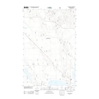
2013 Map of Dunbar Lake
USGS Topo · Published 2013About this map
Chippewa National Forest dominates the landscape of this Northern Minnesota survey, where the winding Popple River and Dunbar River carve through a terrain defined by glacial lakes and wetlands. The settlement of Squaw Lake sits at the southeastern corner of the quadrangle, serving as a local hub with its Po (Post Office) and the nearby N Round Lake Cem. This area, heavily influenced by the logging and forest management of the early 21st century, shows a network of forest roads and county routes like Co HWY 29 and State Hwy 46 that connect the small community of Dunbar to the surrounding wilderness. To the west, Dunbar Lake and its namesake Dunbar Cr provide a focal point for the watershed, while Round Lake and Natures Lake highlight the characteristic aquatic geography of Itasca County.
Find a feature on this map
23 named features on this map. Tap any name to fly to it.
Don’t see what you’re looking for? This feature index may not catch every label — zoom into the map to look around manually.
Map Details
Editions of this 2013 Dunbar Lake Map
This is the sole edition of this map. No revisions or reprints were ever made.
Other maps of this area

1919 · Rosy
USGS Topo · 1:62,500

1919 · Gemmell
USGS Topo · 1:62,500

1919 · Max
USGS Topo · 1:62,500

1919 · Bridgie
USGS Topo · 1:62,500

1924 · Bridgie
USGS Topo · 1:62,500

1954 · Bemidji
USGS Topo · 1:250,000

1957 · Bemidji
USGS Topo · 1:250,000

1958 · Bemidji
USGS Topo · 1:250,000

1971 · Squaw Lake
USGS Topo · 1:24,000

1971 · Dixon Lake
USGS Topo · 1:24,000