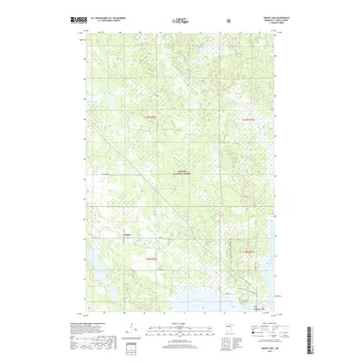
2019 Map of Dunbar Lake
USGS Topo · Published 2019About this map
Chippewa National Forest defines the landscape of this northern Minnesota region, where dense wetlands and complex water systems dominate the terrain. The settlement of Dunbar sits near the headwaters of Dunbar Cr, while the village of Squaw Lake is positioned in the southeast corner near the shores of Round Lake. This modern survey illustrates a landscape primarily managed for conservation and recreation, marked by an extensive network of forestry and local roads like Co Rd 32 and Co Rd 149.
Find a feature on this map
26 named features on this map. Tap any name to fly to it.
Don’t see what you’re looking for? This feature index may not catch every label — zoom into the map to look around manually.
Map Details
Editions of this 2019 Dunbar Lake Map
This is the sole edition of this map. No revisions or reprints were ever made.
Other maps of this area

1919 · Rosy
USGS Topo · 1:62,500

1919 · Gemmell
USGS Topo · 1:62,500

1919 · Max
USGS Topo · 1:62,500

1919 · Bridgie
USGS Topo · 1:62,500

1924 · Bridgie
USGS Topo · 1:62,500

1954 · Bemidji
USGS Topo · 1:250,000

1957 · Bemidji
USGS Topo · 1:250,000

1958 · Bemidji
USGS Topo · 1:250,000

1971 · Squaw Lake
USGS Topo · 1:24,000

1971 · Dixon Lake
USGS Topo · 1:24,000