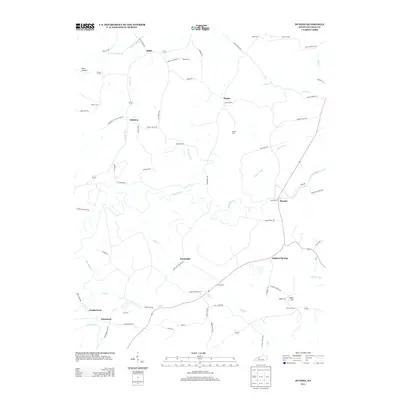
2013 Map of Dundee
USGS Topo · Published 2013About this map
The Rough River meanders across this Ohio County landscape, shaping a network of smaller tributaries including Adams Fork and Halls Cr. Settlement patterns here are tied to the rolling terrain and local family legacies, with small communities like Dundee, Sulphur Springs, and Sunnydale serving as focal points for the rural road system. The presence of several family-named burial grounds, such as Midkiff Cem, Patton Cem, and Wright Cem, suggests a long-standing continuity of residency in the area. Further north, the settlement of Ralph sits near the headwaters of S Fork Panther Creek. One notable landmark of the higher ground is the Adaburg Lookout Tower Rd, indicating the community of Adaburg's historical role in surveying the surrounding timberlands and valleys. This 2013 survey provides a clear view of the modern road network, including names like Jesse Smith Bridge Rd and Marvins Chapel Rd, which link these small hubs together.
Find a feature on this map
74 named features on this map. Tap any name to fly to it.
Don’t see what you’re looking for? This feature index may not catch every label — zoom into the map to look around manually.
Map Details
Editions of this 2013 Dundee Map
This is the sole edition of this map. No revisions or reprints were ever made.
Other maps of this area

1907 · Whitesville
USGS Topo · 1:62,500

1909 · Whitesville
USGS Topo · 1:62,500

1909 · Hartford
USGS Topo · 1:62,500

1925 · Spring Lick
USGS Topo · 1:62,500

1932 · Fordsville
USGS Topo · 1:62,500

1953 · Philpot
USGS Topo · 1:24,000

1953 · Dundee
USGS Topo · 1:24,000

1953 · Whitesville
USGS Topo · 1:24,000

1953 · Pleasant Ridge
USGS Topo · 1:24,000
1953 · Fordsville
USGS Topo · 1:24,000