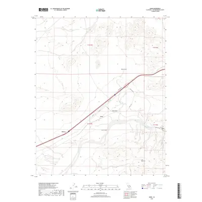
2018 Map of Dunn
USGS Topo · Published 2018About this map
The Mojave River carves a critical path through the arid San Bernardino County landscape, defining the geographic character of this region. This modern topographic study illustrates the sparse but strategic settlement pattern along the major transit corridors of the Mojave Desert. The cluster of small desert outposts including Dunn, New Dunn, and Midway are anchored by the historical trajectory of the Arrowhead Trl, showing how transportation infrastructure dictates human presence in this environment. To the south, the terrain becomes significantly more complex as the river enters Afton Canyon, flanked by the rising elevations of the Cady Mountains. This area serves as a vital drainage point where Wilhelm Wash meets the river valley. The map provides a precise look at the rural road network, including Dunn Rd and Afton Canyon Rd, which connect these isolated settlements to the broader desert expanse.
Find a feature on this map
20 named features on this map. Tap any name to fly to it.
Don’t see what you’re looking for? This feature index may not catch every label — zoom into the map to look around manually.
Map Details
Editions of this 2018 Dunn Map
This is the sole edition of this map. No revisions or reprints were ever made.
Other maps of this area

1933 · Avawatz Mountains
USGS Topo · 1:250,000

1947 · Trona
USGS Topo · 1:250,000

1948 · Trona
USGS Topo · 1:250,000

1948 · Alvord Mountain
USGS Topo · 1:62,500

1948 · Cave Mountain
USGS Topo · 1:62,500

1951 · Cave Mountain
USGS Topo · 1:62,500

1951 · Alvord Mountain
USGS Topo · 1:62,500

1953 · San Bernardino
USGS Topo · 1:250,000

1953 · Trona
USGS Topo · 1:250,000

1955 · Newberry
USGS Topo · 1:62,500