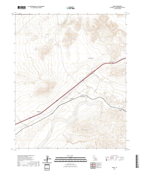
2021 Map of Dunn
USGS Topo · Published 2021About this map
The Mojave River corridor defines this high desert landscape, carving through the Afton Canyon and separating the expansive Mojave Desert from the Cady Mountains to the south. Historically significant transport routes, including the Arrowhead Trl and various county roads, parallel the riverbed, reflecting the long-standing transit importance of this arid region. The map reveals a sequence of small settlements and stopovers along the rail and road corridor, such as Dunn, New Dunn, Midway, and Afton. These locations represent the scattered infrastructure required to maintain connectivity across San Bernardino County. In the south, the terrain transitions into the complex drainage of Wilhelm Wash, illustrating the harsh, water-carved geography of the California interior during the early 21st century.
Find a feature on this map
20 named features on this map. Tap any name to fly to it.
Don’t see what you’re looking for? This feature index may not catch every label — zoom into the map to look around manually.
Map Details
Editions of this 2021 Dunn Map
This is the sole edition of this map. No revisions or reprints were ever made.
Other maps of this area

1933 · Avawatz Mountains
USGS Topo · 1:250,000

1947 · Trona
USGS Topo · 1:250,000

1948 · Trona
USGS Topo · 1:250,000

1948 · Alvord Mountain
USGS Topo · 1:62,500

1948 · Cave Mountain
USGS Topo · 1:62,500

1951 · Cave Mountain
USGS Topo · 1:62,500

1951 · Alvord Mountain
USGS Topo · 1:62,500

1953 · San Bernardino
USGS Topo · 1:250,000

1953 · Trona
USGS Topo · 1:250,000

1955 · Newberry
USGS Topo · 1:62,500