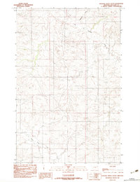
1983 Map of Duplisse Creek South
USGS Topo · Published 1983About this map
East Duplisse Creek and Redwater Creek define the drainage patterns of this portion of Richland County, Montana. The landscape is characterized by a complex network of coulees and ridges typical of the eastern Montana plains, shown here as it was surveyed in the late 1970s. While largely an agricultural and ranching terrain, the presence of a Gravel Pit indicates localized resource extraction necessary for road maintenance and infrastructure in this rural area. In the southern reach of the sheet, the North Fork Lisk Creek meanders through the breaks, illustrating the transition between the higher plateaus and the lower creek beds. This provisional survey captures the precise topography of the drainage divides before modern digital revisions, providing a reliable record of the land contours and watercourses for local researchers.
Find a feature on this map
4 named features on this map. Tap any name to fly to it.
Don’t see what you’re looking for? This feature index may not catch every label — zoom into the map to look around manually.
Map Details
Editions of this 1983 Duplisse Creek South Map
This is the sole edition of this map. No revisions or reprints were ever made.
Other maps of this area

1909 · Glendive
USGS Topo · 1:250,000

1954 · Glendive
USGS Topo · 1:250,000

1957 · Glendive
USGS Topo · 1:250,000

1958 · Glendive
USGS Topo · 1:250,000

1972 · Kuester Lake
USGS Topo · 1:24,000

1981 · Sidney
USGS Topo · 1:100,000
1983 · Duplisse Creek North
USGS Topo · 1:24,000
1983 · Sullivan Coulee
USGS Topo · 1:24,000
1983 · Richey
USGS Topo · 1:24,000

1983 · Richey NW
USGS Topo · 1:24,000