
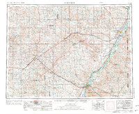
1954 Map of Glendive
USGS Topo · Published 1967About this map
The Yellowstone River and Missouri River define the eastern edge of this mid-century landscape, where river commerce meets the vast agricultural reaches of Eastern Montana. The confluence of these water systems near Andes and Gettysburg Ridge highlights a region built on livestock and grain production, anchored by rural hubs like Circle, Richey, and Brockway. The mapping captures the critical role of rail transport, showing the Northern Pacific and Great Northern lines facilitating movement through the river valleys.
Find a feature on this map
92 named features on this map. Tap any name to fly to it.
Don’t see what you’re looking for? This feature index may not catch every label — zoom into the map to look around manually.
Map Details
Editions of this 1954 Glendive Map
2 editions found
Other maps of this area

1909 · Glendive
USGS Topo · 1:250,000

1912 · Chelsea
USGS Topo · 1:62,500

1912 · Poplar
USGS Topo · 1:62,500

1914 · Brockton
USGS Topo · 1:62,500

1915 · Frazer
USGS Topo · 1:62,500

1915 · Oswego
USGS Topo · 1:62,500

1916 · Wolf Point
USGS Topo · 1:62,500

1953 · Miles City
USGS Topo · 1:250,000

1953 · Williston
USGS Topo · 1:250,000

1953 · Dickinson
USGS Topo · 1:250,000