
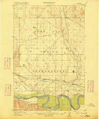
1915 Map of Frazer
USGS Topo · Published 1915About this map
The Fort Peck Indian Reservation dominates this 1915 landscape, showcasing a period of significant transition in northeast Montana. The Great Northern railway cuts a horizontal line across the southern portion of the quadrangle, serving as the primary corridor for settlement and commerce. Along this vital rail link, the settlements of Frazer and Kintyre are established just north of the meandering Missouri River. The river itself serves as a major geographical boundary, separating Valley and Dawson counties. This survey, conducted between 1908 and 1913, illustrates the early 20th-century reliance on both rail transport and natural waterways like Little Porcupine Creek and Farmer Creek. The map provides a clear view of the prairie topography and the emerging infrastructure that would shape the region’s development.
Find a feature on this map
10 named features on this map. Tap any name to fly to it.
Don’t see what you’re looking for? This feature index may not catch every label — zoom into the map to look around manually.
Map Details
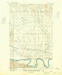
Editions of this 1915 Frazer Map
3 editions found
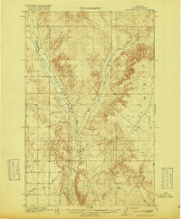
Other maps of this area

1910 · Todd Lakes
USGS Topo · 1:62,500

1914 · Nashua
USGS Topo · 1:62,500

1915 · Oswego
USGS Topo · 1:62,500

1915 · Todd Lakes
USGS Topo · 1:62,500

1915 · Spring Creek
USGS Topo · 1:62,500

1916 · Nashua
USGS Topo · 1:62,500
1918 · Porcupine Valley
USGS Topo · 1:62,500

1954 · Jordan
USGS Topo · 1:250,000

1954 · Glendive
USGS Topo · 1:250,000

1954 · Wolf Point
USGS Topo · 1:250,000