
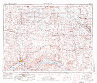
1953 Map of Williston
USGS Topo · Published 1968About this map
The northern reaches of the Sakakawea Lake landscape dominate the southern border of this mid-century study, marking the dramatic transformation of the Missouri River valley. To the north, the high plains are defined by an extensive network of conservation areas, including the Lostwood National Wildlife Refuge and Lake Zahl National Wildlife Refuge, which preserve the region's numerous glacial potholes and lakes.
Find a feature on this map
105 named features on this map. Tap any name to fly to it.
Don’t see what you’re looking for? This feature index may not catch every label — zoom into the map to look around manually.
Map Details
Editions of this 1953 Williston Map
2 editions found
Other maps of this area

1909 · Glendive
USGS Topo · 1:250,000

1911 · Ray
USGS Topo · 1:125,000

1946 · Brush Lake
USGS Topo · 1:24,000

1947 · Bowbells NW
USGS Topo · 1:24,000

1947 · Tolley
USGS Topo · 1:62,500

1947 · Noonan
USGS Topo · 1:24,000

1947 · Flaxton
USGS Topo · 1:24,000

1947 · Bowbells
USGS Topo · 1:24,000

1947 · Columbus
USGS Topo · 1:24,000

1948 · Kenmare
USGS Topo · 1:24,000