
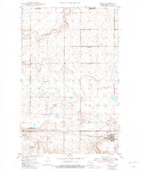
1947 Map of Noonan
USGS Topo · Published 1963About this map
Blooming Valley defines the southern reach of this 1940s survey, where the prairie landscape of Divide County meets the industrial footprint of the northern plains. This area is a significant corridor for the Great Northern and the Minneapolis Sault Ste Marie railroads, which converge near the town of Noonan. The map captures the region's duality, balancing small-town life and rural education at sites like Bluffton School No 4 and Brown School No 4 with the heavy extraction of the local Coalfield. Along the northern edge, the international boundary between Canada and the United States follows a straight survey line just north of the winding Long Creek. The presence of a Strip Mine southeast of Noonan indicates the importance of lignite mining to the local economy during this era, while scattered schoolhouses like School No 1 and School No 3 trace the distribution of early agricultural families.
Find a feature on this map
16 named features on this map. Tap any name to fly to it.
Don’t see what you’re looking for? This feature index may not catch every label — zoom into the map to look around manually.
Map Details
Editions of this 1947 Noonan Map
2 editions found
Other maps of this area

1949 · Columbus SW
USGS Topo · 1:24,000

1949 · Paulson
USGS Topo · 1:24,000

1949 · Atcoal
USGS Topo · 1:24,000

1949 · Noonan SW
USGS Topo · 1:24,000

1949 · Noonan SE
USGS Topo · 1:24,000

1949 · Noonan
USGS Topo · 1:24,000

1950 · Columbus
USGS Topo · 1:62,500

1950 · Noonan
USGS Topo · 1:62,500

1953 · Williston
USGS Topo · 1:250,000

1957 · Williston
USGS Topo · 1:250,000