
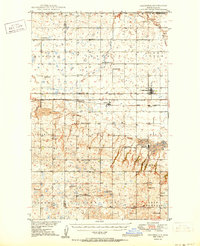
1950 Map of Columbus
USGS Topo · Published 1950About this map
The Canada United States border defines the northern edge of this North Dakota landscape, where the agricultural plains meet a significant industrial corridor in the mid-20th century. The towns of Columbus, Larson, and Kincaid are situated along a dense network of competing rail lines, including the Great Northern and the Minneapolis St Paul and Sault Ste Marie. This infrastructure supported a robust extraction economy, evidenced by the extensive Coal Field and an active Strip Mine west of Kincaid.
Find a feature on this map
38 named features on this map. Tap any name to fly to it.
Don’t see what you’re looking for? This feature index may not catch every label — zoom into the map to look around manually.
Map Details
Editions of this 1950 Columbus Map
2 editions found
Other maps of this area

1947 · Noonan
USGS Topo · 1:24,000

1947 · Columbus
USGS Topo · 1:24,000

1948 · Beaver Lake
USGS Topo · 1:24,000

1948 · Stampede
USGS Topo · 1:24,000

1949 · Columbus SW
USGS Topo · 1:24,000

1949 · Atcoal
USGS Topo · 1:24,000

1949 · Columbus
USGS Topo · 1:24,000

1949 · Noonan SE
USGS Topo · 1:24,000

1949 · Columbus SE
USGS Topo · 1:24,000

1949 · Noonan
USGS Topo · 1:24,000