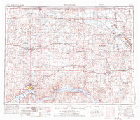
1953 Map of Williston
USGS Topo · Published 1976About this map
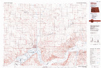
The northwest corner of North Dakota meets the Canadian border in this detailed study of Williams, Divide, Burke, and Ward Counties. The Missouri River's transformation is evident in the sprawling waters of Lake Sakakawea, while the northern plains are defined by the extensive wetland complexes of the Lostwood National Wildlife Refuge and Des Lacs National Wildlife Refuge. Cold War military presence is anchored by the Fortuna Air Force Station near the border, overlooking a landscape of prairie potholes and numerous small lakes like Skermo Lake and Bright Water Lake.
Find a feature on this map
111 named features on this map. Tap any name to fly to it.
Don’t see what you’re looking for? This feature index may not catch every label — zoom into the map to look around manually.
Map Details
Editions of this 1953 Williston Map
2 editions found

Historical Maps of Williston Through Time
3 maps found