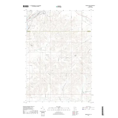
2018 Map of Durand South
USGS Topo · Published 2018About this map
Durand serves as the focal point for this map, situated where the Chippewa River creates a complex network of wetlands and side channels like Thompson Slough. The landscape south of the city is defined by a rhythmic series of deep coulees and valleys, including Stanley Valley, Fox Valley, and Golden Valley, which are separated by prominent features like Dividing Ridge. This topographical pattern reflects the driftless-style erosion typical of the region, where the uplands remain high and the watercourses have carved significant depth into the terrain.
Find a feature on this map
56 named features on this map. Tap any name to fly to it.
Don’t see what you’re looking for? This feature index may not catch every label — zoom into the map to look around manually.
Map Details
Editions of this 2018 Durand South Map
This is the sole edition of this map. No revisions or reprints were ever made.
Other maps of this area

1929 · Durand
USGS Topo · 1:62,500

1932 · Wabasha
USGS Topo · 1:62,500

1932 · Durand
USGS Topo · 1:62,500

1932 · Alma
USGS Topo · 1:62,500

1935 · Arkansaw
USGS Topo · 1:48,000

1941 · Arkansaw
USGS Topo · 1:62,500

1942 · Arkansaw
USGS Topo · 1:62,500

1950 · Alma
USGS Topo · 1:62,500

1951 · Wabasha
USGS Topo · 1:62,500

1953 · Saint Paul
USGS Topo · 1:250,000