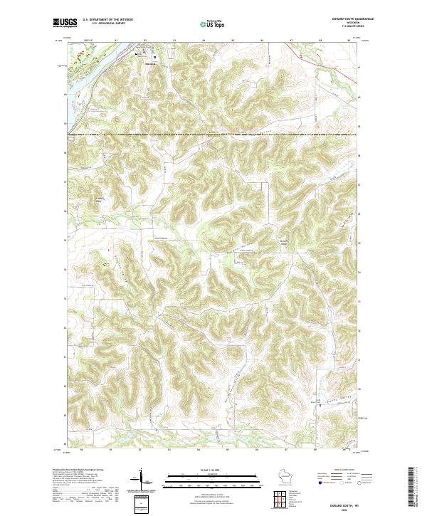
2022 Map of Durand South
USGS Topo · Published 2022About this map
Durand serves as the focal point for this landscape where the Chippewa River carves along the northwestern corner of the Buffalo and Pepin county line. This modern topographic record captures the transition from the river basin to the complex network of ridges and coulees that define the region's geography. The Chippewa River State Trl, following a former rail grade, runs parallel to the water near the Pepin County Government Center.
Find a feature on this map
61 named features on this map. Tap any name to fly to it.
Don’t see what you’re looking for? This feature index may not catch every label — zoom into the map to look around manually.
Map Details
Editions of this 2022 Durand South Map
This is the sole edition of this map. No revisions or reprints were ever made.
Other maps of this area

1929 · Durand
USGS Topo · 1:62,500

1932 · Wabasha
USGS Topo · 1:62,500

1932 · Durand
USGS Topo · 1:62,500

1932 · Alma
USGS Topo · 1:62,500

1935 · Arkansaw
USGS Topo · 1:48,000

1941 · Arkansaw
USGS Topo · 1:62,500

1942 · Arkansaw
USGS Topo · 1:62,500

1950 · Alma
USGS Topo · 1:62,500

1951 · Wabasha
USGS Topo · 1:62,500

1953 · Saint Paul
USGS Topo · 1:250,000