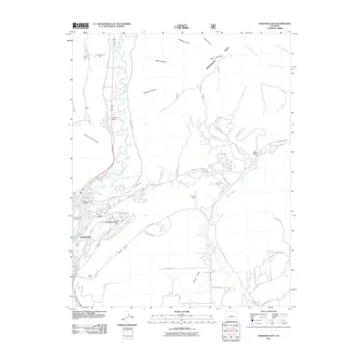
2011 Map of Durango East
USGS Topo · Published 2011About this map
Durango anchors the southwestern portion of this landscape, where the Animas River cuts through the high terrain of Animas City Mountain and Florida Mesa. The geography is defined by a series of deep canyons and ridges, including the prominent Missionary Ridge and Kroeger Canyon, which direct the flow of numerous creeks toward the river valley. The region's industrial past is visible through the presence of several extraction sites such as Schroeder Tunnel Mine, Fireglow Mine, and City Mine.
Find a feature on this map
73 named features on this map. Tap any name to fly to it.
Don’t see what you’re looking for? This feature index may not catch every label — zoom into the map to look around manually.
Map Details
Editions of this 2011 Durango East Map
This is the sole edition of this map. No revisions or reprints were ever made.
Other maps of this area

1898 · Durango
USGS Topo · 1:62,500

1907 · Durango
USGS Topo · 1:62,500

1908 · Ignacio
USGS Topo · 1:125,000

1908 · Durango
USGS Topo · 1:62,500

1924 · Ignacio
USGS Topo · 1:125,000

1945 · Durango
USGS Topo · 1:250,000

1953 · Durango
USGS Topo · 1:250,000

1954 · Durango
USGS Topo · 1:250,000

1961 · Durango
USGS Topo · 1:250,000

1963 · Durango
USGS Topo · 1:250,000