
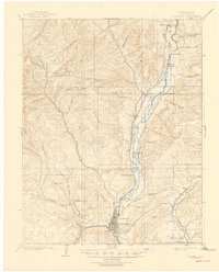
1898 Map of Durango
USGS Topo · Published 1898About this map
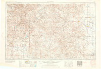
Durango serves as the focal point of this late 19th-century survey, situated at the confluence of Lightner Creek and the Animas River. The landscape is defined by its industrial activity and early rail infrastructure, with the Denver and Rio Grande R. R. and the Rio Grande Southern R. R. (Main Line) threading through the river valleys. Hardrock mining interest is evident in the rugged high country to the west, where operations like the Durango Girl Mine and the Snow Storm Mill occupy remote gulches.
Find a feature on this map
55 named features on this map. Tap any name to fly to it.
Don’t see what you’re looking for? This feature index may not catch every label — zoom into the map to look around manually.
Map Details
Editions of this 1898 Durango Map
This is the sole edition of this map. No revisions or reprints were ever made.
Historical Maps of Durango Through Time
10 maps found
1898 Durango
La Plata County, CO
1907 Durango
La Plata County, CO
1908 Durango
La Plata County, CO
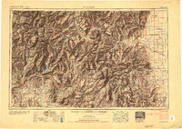
1945 Durango
La Plata County, CO

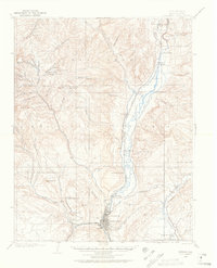
1953 Durango
La Plata County, CO
1954 Durango
La Plata County, CO

1961 Durango
La Plata County, CO

1963 Durango
La Plata County, CO
1966 Durango
La Plata County, CO

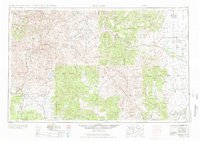
1983 Durango
La Plata County, CO