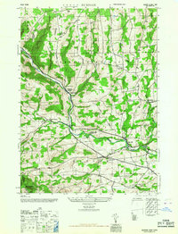
1967 Map of Durham
USGS Topo · Published 1967About this map
Catskill Creek snakes through the borderlands of Albany and Greene Counties, anchoring a rural landscape of scattered hamlets and small school districts. This terrain is defined by its educational and spiritual centers, featuring numerous local landmarks like School No 14 in Preston Hollow and the Cheese Hill School situated below Cheese Hill. The mapping of small local burying grounds, such as Brookside Cem and Pratt Cem, provides a clear view of early settlement patterns in the valleys of Tenmile Creek and Eightmile Creek. Higher elevations like Mt Pisgah and Scott Patent Hill overlook a network of winding roads connecting older communities like Medusa and Oak Hill. The presence of Potter Hollow and Cooksburg along the waterway suggests a mid-20th-century economy still deeply rooted in these narrow valley corridors.
Find a feature on this map
27 named features on this map. Tap any name to fly to it.
Don’t see what you’re looking for? This feature index may not catch every label — zoom into the map to look around manually.
Map Details
Editions of this 1967 Durham Map
This is the sole edition of this map. No revisions or reprints were ever made.
Other maps of this area

1893 · Durham
USGS Topo · 1:62,500

1894 · Durham
USGS Topo · 1:62,500

1898 · Schoharie
USGS Topo · 1:62,500

1900 · Schoharie
USGS Topo · 1:62,500

1900 · Berne
USGS Topo · 1:62,500

1901 · Gilboa
USGS Topo · 1:62,500

1903 · Gilboa
USGS Topo · 1:62,500

1903 · Berne
USGS Topo · 1:62,500
1943 · Westerlo
USGS Topo · 1:24,000
1943 · Freehold
USGS Topo · 1:24,000