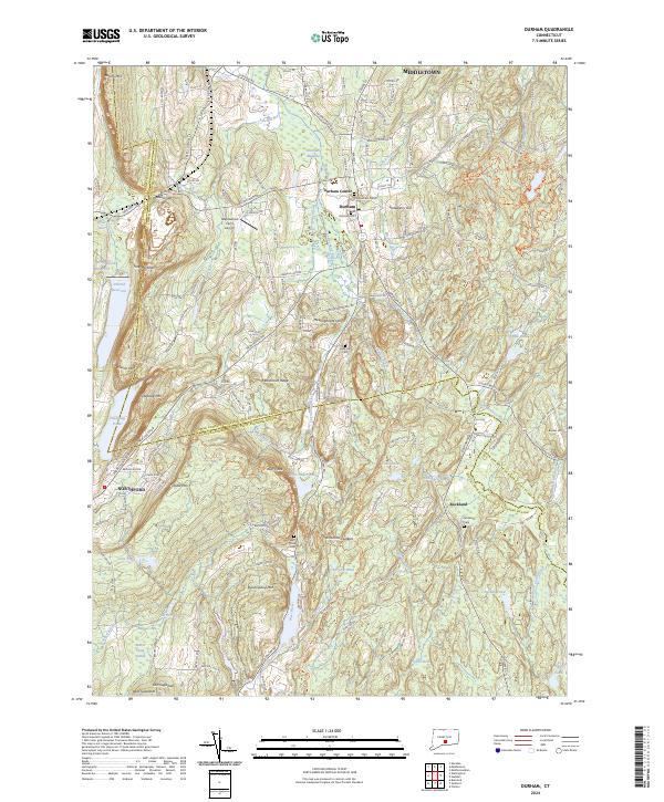
2024 Map of Durham
USGS Topo · Published 2024About this map
Metacomet Ridge dominates the western landscape of this Middlesex County quadrangle, a geologic spine that shapes the surrounding valleys and water systems. This corridor is defined by the Coginchaug River and its numerous tributaries, including Sawmill Brook and Parmelee Brook, which supported the early development of the village centers at Durham and Durham Center. The map preserves the placement of local historical sites, from the Old Durham Cem to the Mica Hill Cem, reflecting generations of settlement along the ridgelines. Further south, the terrain transitions toward the hills of Northford and the remote settlement of Rockland, where the Hammonasset River begins its course. Notable peaks like Beseck Mtn, Fowler Mtn, and Pistapaug Mtn overlook a complex network of reservoirs and ponds, including the deep waters of Lake Quonnipaug and Ulbrich Reservoir.
Find a feature on this map
76 named features on this map. Tap any name to fly to it.
Don’t see what you’re looking for? This feature index may not catch every label — zoom into the map to look around manually.
Map Details
Editions of this 2024 Durham Map
This is the sole edition of this map. No revisions or reprints were ever made.
Other maps of this area

1892 · New Haven
USGS Topo · 1:62,500

1892 · Meriden
USGS Topo · 1:62,500

1893 · Guilford
USGS Topo · 1:62,500

1893 · Middletown
USGS Topo · 1:62,500

1893 · Meriden
USGS Topo · 1:62,500

1906 · Farmington
USGS Topo · 1:125,000

1921 · New Haven
USGS Topo · 1:62,500

1928 · Cromwell
USGS Topo · 1:24,000

1943 · Durham
USGS Topo · 1:25,000

1945 · Middle Haddam
USGS Topo · 1:31,680