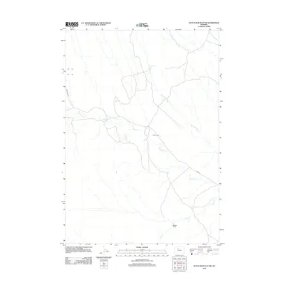
2012 Map of Dutch Nick Flat NW
USGS Topo · Published 2012About this map
Mueller Cabin sits as a lone human landmark in this section of Washakie County, characterized by a complex network of ephemeral drainage systems. The landscape is defined by the winding course of Fifteenmile Cr and its various tributaries, including Timber Cr and Rock Waterhole Cr, which carve through the high plains. This 2012 survey illustrates a sparsely populated region where infrastructure is limited to secondary routes like Fenton Pass Rd and 15 Mile Rd. The inclusion of Bobcat Draw and Dry Cottonwood Cr highlights the rugged, water-dependent topography of the Wyoming basin, where geography and survival revolve around these seasonal watercourses and remote shelters.
Find a feature on this map
8 named features on this map. Tap any name to fly to it.
Don’t see what you’re looking for? This feature index may not catch every label — zoom into the map to look around manually.
Map Details
Editions of this 2012 Dutch Nick Flat NW Map
This is the sole edition of this map. No revisions or reprints were ever made.
Other maps of this area

1951 · Sucker Dam
USGS Topo · 1:24,000

1951 · Dutch Nick Flat
USGS Topo · 1:24,000

1951 · Dutch Nick Flat SW
USGS Topo · 1:24,000

1951 · Gillies Draw
USGS Topo · 1:24,000

1951 · Sheep Mountain
USGS Topo · 1:24,000

1951 · Tatman Mountain
USGS Topo · 1:24,000

1951 · Wardel Reservoir
USGS Topo · 1:24,000

1951 · Dead Indian Hill
USGS Topo · 1:24,000

1951 · Dutch Nick Flat NW
USGS Topo · 1:24,000

1955 · Cody
USGS Topo · 1:250,000