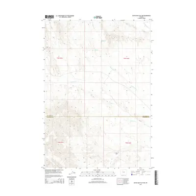
2015 Map of Dutch Nick Flat NW
USGS Topo · Published 2015About this map
Fifteenmile Cr winds across this arid landscape at the border of Big Horn and Washakie Counties. The map reveals the critical importance of water management in this high-desert environment, evidenced by man-made catchments like Red Spires Reservoir and Big Von Reservoir. The drainage patterns are defined by seasonal watercourses such as Rock Waterhole Cr, Dry Cottonwood Cr, and Timber Cr, which carve through the terrain and converge toward Bobcat Draw. Access through this remote territory is largely limited to unpaved routes like 15 Mile Rd, illustrating the sparse development typical of the Bighorn Basin during the early twenty-first century. This topographic study captures the intersection of natural erosion and human engineering in a region where every drop of water is meticulously directed.
Find a feature on this map
13 named features on this map. Tap any name to fly to it.
Don’t see what you’re looking for? This feature index may not catch every label — zoom into the map to look around manually.
Map Details
Editions of this 2015 Dutch Nick Flat NW Map
This is the sole edition of this map. No revisions or reprints were ever made.
Other maps of this area

1951 · Sucker Dam
USGS Topo · 1:24,000

1951 · Dutch Nick Flat
USGS Topo · 1:24,000

1951 · Dutch Nick Flat SW
USGS Topo · 1:24,000

1951 · Gillies Draw
USGS Topo · 1:24,000

1951 · Sheep Mountain
USGS Topo · 1:24,000

1951 · Tatman Mountain
USGS Topo · 1:24,000

1951 · Wardel Reservoir
USGS Topo · 1:24,000

1951 · Dead Indian Hill
USGS Topo · 1:24,000

1951 · Dutch Nick Flat NW
USGS Topo · 1:24,000

1955 · Cody
USGS Topo · 1:250,000