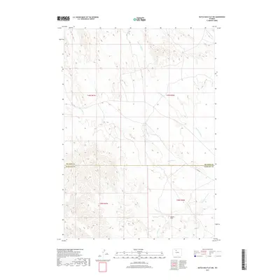
2017 Map of Dutch Nick Flat NW
USGS Topo · Published 2017About this map
Fifteenmile Creek and its network of ephemeral tributaries define the high plains drainage on this portion of the Bighorn Basin. In this arid reach of Washakie County, the land is dominated by a complex system of draws and seasonal watercourses, including Rock Waterhole Creek and the meandering Bobcat Draw. The landscape's management is clearly delineated by the Big Horn and Washakie County boundary line, which cuts horizontally across the terrain near the passage of 15 Mile Road. This corridor represents a critical east-west connection through the sparse interior of the basin, following the natural contours shaped by the Timber Creek headwaters and Dry Cottonwood Creek. The map provides a detailed view of the public land survey system, showing the township and range divisions that have historically structured Wyoming's ranching and resource development.
Find a feature on this map
11 named features on this map. Tap any name to fly to it.
Don’t see what you’re looking for? This feature index may not catch every label — zoom into the map to look around manually.
Map Details
Editions of this 2017 Dutch Nick Flat NW Map
This is the sole edition of this map. No revisions or reprints were ever made.
Other maps of this area

1951 · Sucker Dam
USGS Topo · 1:24,000

1951 · Dutch Nick Flat
USGS Topo · 1:24,000

1951 · Dutch Nick Flat SW
USGS Topo · 1:24,000

1951 · Gillies Draw
USGS Topo · 1:24,000

1951 · Sheep Mountain
USGS Topo · 1:24,000

1951 · Tatman Mountain
USGS Topo · 1:24,000

1951 · Wardel Reservoir
USGS Topo · 1:24,000

1951 · Dead Indian Hill
USGS Topo · 1:24,000

1951 · Dutch Nick Flat NW
USGS Topo · 1:24,000

1955 · Cody
USGS Topo · 1:250,000