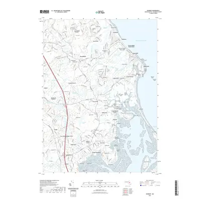
2021 Map of Duxbury
USGS Topo · Published 2021About this map
The coastal landscapes of Duxbury and Marshfield are defined by a complex network of salt marshes and tidal inlets, where the South River and Green Harbor River meet the Atlantic. This 2021 survey illustrates the modern layout of several long-established seaside communities, including Ocean Bluff-Brant Rock, Green Harbor, and Rexhame. Significant local history is preserved at the Myles Standish Burying Ground and Mayflower Cem, reflecting the deep colonial roots of this region.
Find a feature on this map
282 named features on this map. Tap any name to fly to it.
Don’t see what you’re looking for? This feature index may not catch every label — zoom into the map to look around manually.
Map Details
Editions of this 2021 Duxbury Map
This is the sole edition of this map. No revisions or reprints were ever made.
Other maps of this area

1885 · Abington
USGS Topo · 1:62,500

1885 · Duxbury
USGS Topo · 1:62,500

1885 · Middleboro
USGS Topo · 1:62,500

1886 · Plymouth
USGS Topo · 1:62,500

1888 · Duxbury
USGS Topo · 1:62,500

1888 · Middleboro
USGS Topo · 1:62,500

1888 · Abington
USGS Topo · 1:62,500

1889 · Plymouth
USGS Topo · 1:62,500

1893 · Abington
USGS Topo · 1:62,500

1893 · Duxbury
USGS Topo · 1:62,500