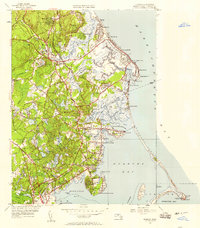
1947 Map of Duxbury
USGS Topo · Published 1958About this map
Historical landmarks of the Pilgrim era and early American maritime life are meticulously recorded across this coastal landscape. The Myles Standish Monument and the Site of Myles Standish House stand at the southern tip near Captain Hill, while the John Alden House and the Old Burying Ground First Parish Church offer clear evidence of the region's deep colonial roots in Duxbury. The landscape is a complex network of Cranberry Bogs and marshes, where the Green Harbor River and Bluefish River meet the Atlantic.
Find a feature on this map
83 named features on this map. Tap any name to fly to it.
Don’t see what you’re looking for? This feature index may not catch every label — zoom into the map to look around manually.
Map Details
Editions of this 1947 Duxbury Map
This is the sole edition of this map. No revisions or reprints were ever made.
Other maps of this area

1885 · Abington
USGS Topo · 1:62,500

1885 · Duxbury
USGS Topo · 1:62,500

1885 · Middleboro
USGS Topo · 1:62,500

1886 · Plymouth
USGS Topo · 1:62,500

1888 · Duxbury
USGS Topo · 1:62,500

1888 · Middleboro
USGS Topo · 1:62,500

1888 · Abington
USGS Topo · 1:62,500

1889 · Plymouth
USGS Topo · 1:62,500

1893 · Abington
USGS Topo · 1:62,500

1893 · Duxbury
USGS Topo · 1:62,500