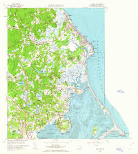
1961 Map of Duxbury
USGS Topo · Published 1963About this map
Captains Hill and the Standish Monument anchor this coastal landscape where Plymouth Colony history remains visible on the mid-century terrain. The map meticulously documents the geography of the South Shore, from the tidal flats of Duxbury Bay to the marshy reaches of the South River. Genealogists and historians will find significant ancestral sites, including the John Alden House, the Governor Winslow House, and the Old Burying Ground, which holds the grave of Myles Standish. The region's agricultural and industrial character is evident through numerous Cranberry Bogs and the Marshfield Fairgrounds. Navigation and communication landmarks are also prominent, such as the Plymouth Lighthouse at Gurnet Point and the USCG Radio Station. From the seaside settlements of Brant Rock and Green Harbor to inland junctions like Tree of Knowledge Corner, the map illustrates a community shaped by its maritime heritage and early colonial foundations.
Find a feature on this map
137 named features on this map. Tap any name to fly to it.
Don’t see what you’re looking for? This feature index may not catch every label — zoom into the map to look around manually.
Map Details
Editions of this 1961 Duxbury Map
This is the sole edition of this map. No revisions or reprints were ever made.
Other maps of this area

1885 · Abington
USGS Topo · 1:62,500

1885 · Duxbury
USGS Topo · 1:62,500

1885 · Middleboro
USGS Topo · 1:62,500

1886 · Plymouth
USGS Topo · 1:62,500

1888 · Duxbury
USGS Topo · 1:62,500

1888 · Middleboro
USGS Topo · 1:62,500

1888 · Abington
USGS Topo · 1:62,500

1889 · Plymouth
USGS Topo · 1:62,500

1893 · Abington
USGS Topo · 1:62,500

1893 · Duxbury
USGS Topo · 1:62,500