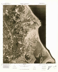
1977 Map of Duxbury
USGS Topo · Published 1981About this map
The winding course of the South River and the complex tidal marshes of the South Shore define this 1977 orthophotograph. Captured by the U.S. Geological Survey and the Commonwealth of Massachusetts Department of Public Works, this aerial perspective reveals the mid-century development patterns across Marshfield and Duxbury. The map illustrates the contrast between the densely wooded inland areas and the established coastal settlements of Fieldston and Green Harbor. Looking south toward Kingston, the imagery provides a clear view of the delicate landforms separating Massachusetts Bay from the sheltered waters of Plymouth Bay. This orthophotograph is particularly valuable for documenting the extent of residential expansion and coastal infrastructure before late-century conservation efforts and further suburbanization reshaped the shoreline character of South Duxbury.
Find a feature on this map
9 named features on this map. Tap any name to fly to it.
Don’t see what you’re looking for? This feature index may not catch every label — zoom into the map to look around manually.
Map Details
Editions of this 1977 Duxbury Map
This is the sole edition of this map. No revisions or reprints were ever made.
Other maps of this area

1885 · Abington
USGS Topo · 1:62,500

1885 · Duxbury
USGS Topo · 1:62,500

1885 · Middleboro
USGS Topo · 1:62,500

1886 · Plymouth
USGS Topo · 1:62,500

1888 · Duxbury
USGS Topo · 1:62,500

1888 · Middleboro
USGS Topo · 1:62,500

1888 · Abington
USGS Topo · 1:62,500

1889 · Plymouth
USGS Topo · 1:62,500

1893 · Abington
USGS Topo · 1:62,500

1893 · Duxbury
USGS Topo · 1:62,500