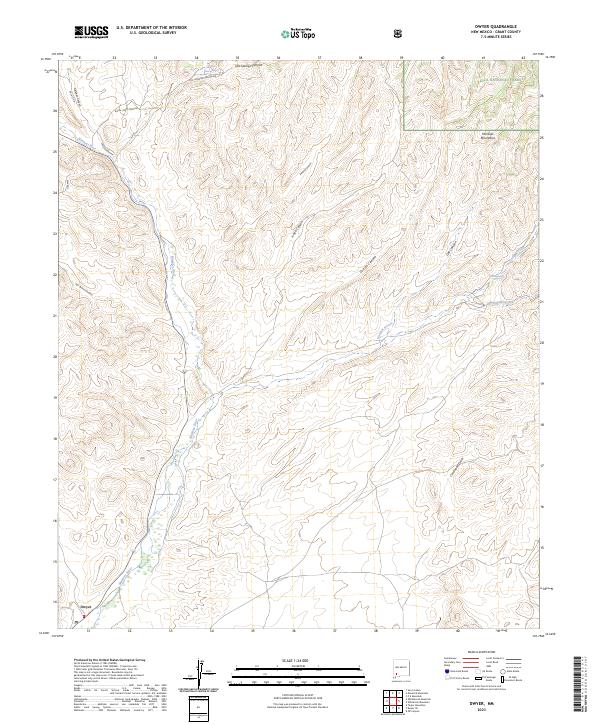
2023 Map of Dwyer
USGS Topo · Published 2023About this map
Dwyer sits along the Mimbres River in a landscape where steep canyons and arid draws converge. This Grant County terrain is defined by its drainage systems, from the broad Gavilan Arroyo to the narrow confines of Donahue Canyon and Juniper Canyon. To the northeast, the land rises into the Mimbres Mountains and the protected boundaries of the Gila National Forest. The map shows a network of named tracks that suggest the area's history of mineral exploration and ranching, including Royal John Mine Rd and Hot Springs Canyon Rd. Water sources are critical landmarks in this environment, represented by Hot Springs in the north and Goat Spring further east, which historically served as vital points for local inhabitants and livestock in the high desert.
Find a feature on this map
26 named features on this map. Tap any name to fly to it.
Don’t see what you’re looking for? This feature index may not catch every label — zoom into the map to look around manually.
Map Details
Editions of this 2023 Dwyer Map
This is the sole edition of this map. No revisions or reprints were ever made.
Other maps of this area

1935 · Hillsboro
USGS Topo · 1:48,000

1940 · Hillsboro
USGS Topo · 1:62,500

1955 · Las Cruces
USGS Topo · 1:250,000

1956 · Dwyer
USGS Topo · 1:62,500

1956 · San Lorenzo
USGS Topo · 1:62,500

1958 · Las Cruces
USGS Topo · 1:250,000

1962 · Lake Valley
USGS Topo · 1:62,500

1982 · Hatch
USGS Topo · 1:100,000
1985 · Dwyer
USGS Topo · 1:24,000
1985 · P A Mountain
USGS Topo · 1:24,000