
1956 Map of Dwyer
USGS Topo · Published 1958About this map
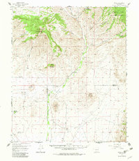
The Mimbres River valley serves as the central artery for this mid-century New Mexico landscape, anchoring a series of small settlements and ranching outposts. The community of Dwyer (Faywood PO) is located along the river, near the San Jose Ch and a local Cem, reflecting a long-established rural social structure. Further north, the river passes through Swartz and Sherman, while various cattle operations like the Y Bar Nan Ranch and Eby Ranch suggest the region's agricultural foundations.
Find a feature on this map
35 named features on this map. Tap any name to fly to it.
Don’t see what you’re looking for? This feature index may not catch every label — zoom into the map to look around manually.
Map Details
Editions of this 1956 Dwyer Map
2 editions found
Other maps of this area

1899 · Deming
USGS Topo · 1:125,000

1909 · Silver City
USGS Topo · 1:125,000

1915 · Deming
USGS Topo · 1:125,000

1935 · Hillsboro
USGS Topo · 1:48,000

1937 · Santa Rita
USGS Topo · 1:24,000

1940 · Hillsboro
USGS Topo · 1:62,500

1947 · Faywood Station
USGS Topo · 1:24,000

1948 · Santa Rita
USGS Topo · 1:24,000

1948 · Hurley East
USGS Topo · 1:24,000

1949 · Hurley East
USGS Topo · 1:24,000