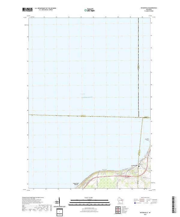
2022 Map of Dyckesville
USGS Topo · Published 2022About this map
Dyckesville sits at the convergence of three Wisconsin counties along the southern waters of Green Bay. This 2022 survey captures the shoreline community where Brown, Kewaunee, and Door counties meet, a region defined by its coastal orientation and rural road network. The landscape transitions from the open waters of Lake Michigan to the rising terrain of Barretts Point, with residential clusters gathered at Edgewater Beach. Local history is anchored by the Saint Louis Catholic Cem, located near the junction of Co Rd DK and Co Rd S. A contemporary addition to the map is the designated Water Trail following the coast, reflecting the modern recreational use of these historical fishing and farming shores. The grid of local roads, including Tielens RD and Bader RD, suggests a persistent pattern of family landholdings reaching toward the bluff.
Find a feature on this map
32 named features on this map. Tap any name to fly to it.
Don’t see what you’re looking for? This feature index may not catch every label — zoom into the map to look around manually.
Map Details
Editions of this 2022 Dyckesville Map
This is the sole edition of this map. No revisions or reprints were ever made.
Other maps of this area

1952 · Casco
USGS Topo · 1:62,500

1954 · New Franken
USGS Topo · 1:62,500

1954 · Green Bay East
USGS Topo · 1:24,000

1954 · Manitowoc
USGS Topo · 1:250,000

1956 · Oconto
USGS Topo · 1:62,500

1958 · Manitowoc
USGS Topo · 1:250,000

1961 · Little Sturgeon
USGS Topo · 1:62,500
1974 · Pensaukee
USGS Topo · 1:24,000
1974 · Oconto SE
USGS Topo · 1:24,000
1974 · Little Tail Point
USGS Topo · 1:24,000