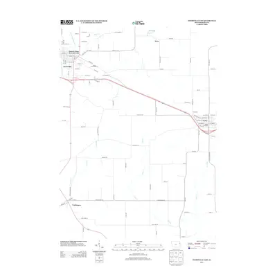
2013 Map of Dyersville East
USGS Topo · Published 2013About this map
Field of Dreams stands as a prominent landmark on this 2013 landscape, located just northeast of Dyersville in Dubuque County. The area is defined by the N Fork Maquoketa River and a network of agricultural drainage including Hewitt Cr and Johns Cr. While Dyersville serves as a primary hub with developments like Summit Village and Dyersville Park, the map also captures the surrounding communities of Farley and Worthington. Local recreation and sport are well-represented by the Rolling Knolls Golf Course and the Farley Racetrack. The transport network shows a transition from the structured street grids of the towns to a rural grid of named roads such as Dyersville E Rd and Olde Hawkeye Rd, reflecting the enduring agricultural character of the region.
Find a feature on this map
91 named features on this map. Tap any name to fly to it.
Don’t see what you’re looking for? This feature index may not catch every label — zoom into the map to look around manually.
Map Details
Editions of this 2013 Dyersville East Map
This is the sole edition of this map. No revisions or reprints were ever made.
Other maps of this area

1900 · Anamosa
USGS Topo · 1:125,000

1900 · Lancaster
USGS Topo · 1:125,000

1901 · Peosta
USGS Topo · 1:125,000

1902 · Elkader
USGS Topo · 1:125,000

1904 · Lancaster
USGS Topo · 1:125,000

1908 · Lancaster
USGS Topo · 1:125,000

1957 · Holy Cross
USGS Topo · 1:24,000

1959 · Dubuque
USGS Topo · 1:250,000

1961 · Dubuque
USGS Topo · 1:250,000

1962 · Dubuque
USGS Topo · 1:250,000