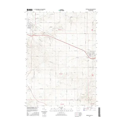
2015 Map of Dyersville East
USGS Topo · Published 2015About this map
Saint Boniface Catholic Cem and Mount Hope Cem serve as prominent landmarks on the outskirts of Dyersville, documenting the genealogical history of this eastern Iowa region. The landscape transitions from the urban blocks of Dyersville and Farley into a grid of rural section lines defined by routes like Rockville Rd and Dyersville E Rd. Waterways such as the N Fork Maquoketa River, Hewitt Cr, and Johns Cr cut through the terrain, influencing the placement of smaller locales like Mekee. This topographic survey illustrates the intersection of established agriculture and expanding township infrastructure, where family-named landmarks like McGee Cem and Fairview Cem remain preserved alongside modern thoroughfares.
Find a feature on this map
65 named features on this map. Tap any name to fly to it.
Don’t see what you’re looking for? This feature index may not catch every label — zoom into the map to look around manually.
Map Details
Editions of this 2015 Dyersville East Map
This is the sole edition of this map. No revisions or reprints were ever made.
Other maps of this area

1900 · Anamosa
USGS Topo · 1:125,000

1900 · Lancaster
USGS Topo · 1:125,000

1901 · Peosta
USGS Topo · 1:125,000

1902 · Elkader
USGS Topo · 1:125,000

1904 · Lancaster
USGS Topo · 1:125,000

1908 · Lancaster
USGS Topo · 1:125,000

1957 · Holy Cross
USGS Topo · 1:24,000

1959 · Dubuque
USGS Topo · 1:250,000

1961 · Dubuque
USGS Topo · 1:250,000

1962 · Dubuque
USGS Topo · 1:250,000