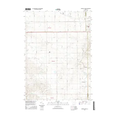
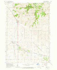
2015 Map of Dyersville West
USGS Topo · Published 2015About this map
The North Fork Maquoketa River carves a path through the eastern portion of this landscape, anchoring the settlements of Dyersville, Rockville, and Worthington. This agricultural region on the border of Delaware and Dubuque counties is defined by a dense grid of range roads and creek systems, including Plum Creek and Cooksley Cr. The map captures the interface between traditional town centers and modern infrastructure, evidenced by the Dyersville Area Airport and the expansion of residential streets such as 8th Ave NW and 18th Ave SW. Genealogical interest is found in local landmarks like Saint Francis Cem and Rockville Cem, which preserve the history of the families that established these farming communities. The small settlement of Gilt Edge sits centrally, illustrating the persistent network of smaller locales that define rural Iowa.
Find a feature on this map
61 named features on this map. Tap any name to fly to it.
Don’t see what you’re looking for? This feature index may not catch every label — zoom into the map to look around manually.
Map Details
Editions of this 2015 Dyersville West Map
This is the sole edition of this map. No revisions or reprints were ever made.
Other maps of this area

1900 · Anamosa
USGS Topo · 1:125,000

1902 · Elkader
USGS Topo · 1:125,000

1959 · Dubuque
USGS Topo · 1:250,000

1961 · Dubuque
USGS Topo · 1:250,000

1962 · Dubuque
USGS Topo · 1:250,000
1962 · New Vienna
USGS Topo · 1:24,000

1962 · Petersburg
USGS Topo · 1:24,000
1965 · Dyersville West
USGS Topo · 1:24,000
1965 · Dyersville East
USGS Topo · 1:24,000
1965 · Greeley
USGS Topo · 1:24,000