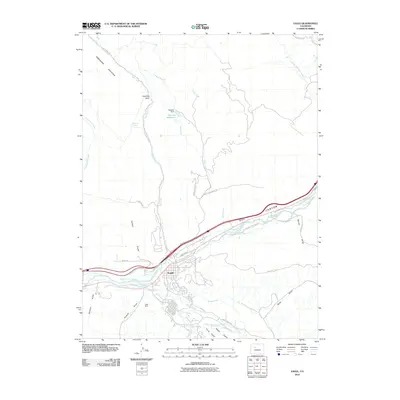
2010 Map of Eagle
USGS Topo · Published 2010About this map
Eagle serves as the focal point of this 2010 topographic survey, situated at the confluence of the Eagle River and Brush Creek. The landscape is defined by an intricate network of irrigation systems essential to the region's agricultural history, including the Squire and Hammond Ditch, Hockett Ditch, and Hollingsworth Ditch. These man-made watercourses follow the natural contours of the valley, branching off from the river to support local land use between the steep elevations of Greenhorn Mountain and the distinctively colored Red Canyon.
Find a feature on this map
47 named features on this map. Tap any name to fly to it.
Don’t see what you’re looking for? This feature index may not catch every label — zoom into the map to look around manually.
Map Details
Editions of this 2010 Eagle Map
This is the sole edition of this map. No revisions or reprints were ever made.
Other maps of this area

1957 · Leadville
USGS Topo · 1:250,000

1959 · Leadville
USGS Topo · 1:250,000

1960 · Leadville
USGS Topo · 1:250,000

1962 · Leadville
USGS Topo · 1:250,000

1962 · Gypsum
USGS Topo · 1:24,000
1962 · Suicide Mountain
USGS Topo · 1:24,000

1962 · Fulford
USGS Topo · 1:24,000

1962 · Wolcott
USGS Topo · 1:24,000

1962 · Eagle
USGS Topo · 1:24,000
1962 · The Seven Hermits
USGS Topo · 1:24,000