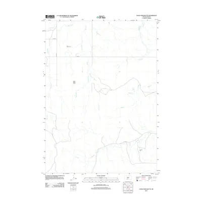
2012 Map of Eagle Mans Butte
USGS Topo · Published 2012About this map
Eagle Mans Butte rises as a prominent landmark in this prairie landscape, serving as a focal point for a complex drainage system in Bennett County. The terrain is defined by numerous winding waterways, including the southward-reaching Black Pipe Cr, Red Leaf Cr, and Eagle Chief Cr. Evidence of the area's rural community structure is found at the Saint Stephen Cem near the northern border and Epiphany Cem further south. These sites, along with isolated markers like Black Crow Spring, suggest a history of deep-rooted local settlement. The transition from established section-line roads like 279th St to more specialized routes like He Dog Rd illustrates the intersection of traditional land divisions and modern infrastructure within this sparsely populated region of South Dakota.
Find a feature on this map
17 named features on this map. Tap any name to fly to it.
Don’t see what you’re looking for? This feature index may not catch every label — zoom into the map to look around manually.
Map Details
Editions of this 2012 Eagle Mans Butte Map
This is the sole edition of this map. No revisions or reprints were ever made.
Other maps of this area

1955 · Martin
USGS Topo · 1:250,000

1958 · Martin
USGS Topo · 1:250,000

1969 · Norris
USGS Topo · 1:24,000

1969 · Eagle Mans Butte
USGS Topo · 1:24,000

1969 · Parmelee NE
USGS Topo · 1:24,000

1969 · Parmelee
USGS Topo · 1:24,000

1969 · Iron Shell Flat East
USGS Topo · 1:24,000

1969 · Iron Shell Flat West
USGS Topo · 1:24,000

1981 · Long Valley
USGS Topo · 1:25,000

1981 · Blackpipe
USGS Topo · 1:25,000