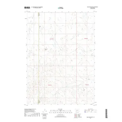
2017 Map of Eagle Mans Butte
USGS Topo · Published 2017About this map
Eagle Mans Butte stands as a prominent landmark on the high plains where the border between Bennett Co and Todd Co divides the landscape. This 2017 survey reveals a terrain defined by an intricate network of drainages, including Black Pipe Cr, Black Elk Cr, and Eagle Chief Cr, which carve through the open country. The distribution of remote burial sites like Saint Stephen Cem in the north and Epiphany Cem in the south provides important coordinates for genealogists and local historians tracing families in this part of South Dakota. The presence of Black Crow Spring and names like Red Leaf Cr reflect the area's cultural heritage and reliance on seasonal water sources. Local transit is marked by established routes such as Whipple Rd and He Dog Rd, which navigate the elevation changes around the butte.
Find a feature on this map
22 named features on this map. Tap any name to fly to it.
Don’t see what you’re looking for? This feature index may not catch every label — zoom into the map to look around manually.
Map Details
Editions of this 2017 Eagle Mans Butte Map
This is the sole edition of this map. No revisions or reprints were ever made.
Other maps of this area

1955 · Martin
USGS Topo · 1:250,000

1958 · Martin
USGS Topo · 1:250,000

1969 · Norris
USGS Topo · 1:24,000

1969 · Eagle Mans Butte
USGS Topo · 1:24,000

1969 · Parmelee NE
USGS Topo · 1:24,000

1969 · Parmelee
USGS Topo · 1:24,000

1969 · Iron Shell Flat East
USGS Topo · 1:24,000

1969 · Iron Shell Flat West
USGS Topo · 1:24,000

1981 · Long Valley
USGS Topo · 1:25,000

1981 · Blackpipe
USGS Topo · 1:25,000