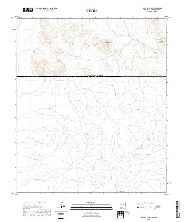
2023 Map of Eagle Mountain
USGS Topo · Published 2023About this map
Eagle Mountain and the surrounding high desert of Hidalgo County define this remote borderland landscape. Located along the international boundary between the United States and Mexico, the terrain is characterized by the prominent peaks of the Dog Mountains and Middle Mountain. In this arid environment, water management is the primary evidence of human modification to the land, seen in the strategically placed Big Tank and Middle Mountain Tank. The intermittent drainage of Willow Creek threads through the northern sections of the map, illustrating the natural watercourses that dictate the movement of both people and wildlife across this isolated region. This survey captures a moment in the modern era where the land remains largely defined by its natural topography rather than dense settlement.
Find a feature on this map
9 named features on this map. Tap any name to fly to it.
Don’t see what you’re looking for? This feature index may not catch every label — zoom into the map to look around manually.
Map Details
Editions of this 2023 Eagle Mountain Map
This is the sole edition of this map. No revisions or reprints were ever made.
Other maps of this area

1917 · Antelope Wells
USGS Topo · 1:62,500

1918 · Dog Mountains
USGS Topo · 1:62,500

1919 · Antelope Wells
USGS Topo · 1:62,500

1955 · Douglas
USGS Topo · 1:250,000

1959 · Douglas
USGS Topo · 1:250,000

1961 · Douglas
USGS Topo · 1:250,000

1964 · Douglas
USGS Topo · 1:250,000
1982 · Pierce Peak
USGS Topo · 1:24,000
1982 · Hilo Peak
USGS Topo · 1:24,000
1982 · Sentinel Butte
USGS Topo · 1:24,000