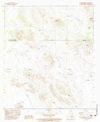
1983 Map of Eagle Mountain
USGS Topo · Published 1983About this map
The international border between the United States of America and Estados Unidos Mexicanos bisects this 1983 survey, illustrating the desert landscape where New Mexico meets Chihuahua. North of the line, Eagle Mountain and Middle Mountain dominate the terrain in Hidalgo County, with water sources like Willow Creek and Big Tank providing critical infrastructure in the arid environment. South of the border, the map details a network of named locales and landmarks such as El Rayado, El Potrero, and El Aguila. This cartographic record is notable for its bilingual orientation, capturing the transition between the American Southwest and Northern Mexico. The placement of features like El Contrabando and La Linea suggests the long-standing importance of this boundary region for movement and monitoring across the high desert floor.
Find a feature on this map
30 named features on this map. Tap any name to fly to it.
Don’t see what you’re looking for? This feature index may not catch every label — zoom into the map to look around manually.
Map Details
Editions of this 1983 Eagle Mountain Map
This is the sole edition of this map. No revisions or reprints were ever made.
Other maps of this area

1917 · Antelope Wells
USGS Topo · 1:62,500

1918 · Dog Mountains
USGS Topo · 1:62,500

1919 · Antelope Wells
USGS Topo · 1:62,500

1955 · Douglas
USGS Topo · 1:250,000

1959 · Douglas
USGS Topo · 1:250,000

1961 · Douglas
USGS Topo · 1:250,000

1964 · Douglas
USGS Topo · 1:250,000
1982 · Pierce Peak
USGS Topo · 1:24,000
1982 · Hilo Peak
USGS Topo · 1:24,000
1982 · Sentinel Butte
USGS Topo · 1:24,000