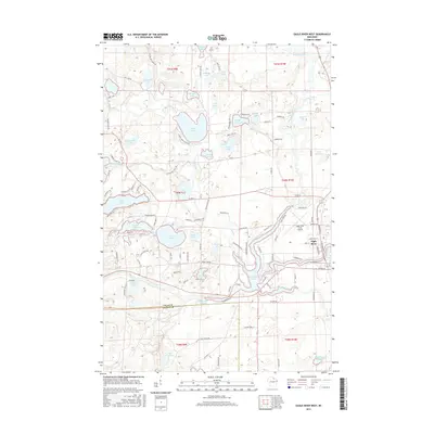
2015 Map of Eagle River West
USGS Topo · Published 2015About this map
Wisconsin River meanders through the heart of this landscape, defining the transition between the dense lake clusters of Vilas and Oneida counties. The western edge of Eagle River sits near the eastern margin, anchored by the Eagle River Union Airport and a local street grid including Minnesota St and N Railroad St. This region is characterized by an intricate network of glacial lakes, from the large expanse of Boot Lake and Hunter Lake to smaller basins like Tepee Lake and Bullfrog Lake. The map reveals how local transportation has adapted to this water-dominant terrain, with routes like Co Rd G and Star Lake Rd threading between bodies of water. The presence of numerous named game trails, such as Mc Leod Lake Game Trl and Katie Lake Game Trl, indicates a landscape deeply tied to outdoor recreation and seasonal use.
Find a feature on this map
113 named features on this map. Tap any name to fly to it.
Don’t see what you’re looking for? This feature index may not catch every label — zoom into the map to look around manually.
Map Details
Editions of this 2015 Eagle River West Map
This is the sole edition of this map. No revisions or reprints were ever made.
Other maps of this area

1928 · Three Lakes
USGS Topo · 1:48,000

1930 · Robbins
USGS Topo · 1:48,000

1938 · Phelps
USGS Topo · 1:48,000

1938 · Three Lakes
USGS Topo · 1:48,000

1938 · Robbins
USGS Topo · 1:48,000

1945 · Three Lakes
USGS Topo · 1:48,000

1945 · Robbins
USGS Topo · 1:48,000

1946 · Star Lake
USGS Topo · 1:48,000

1950 · Phelps
USGS Topo · 1:48,000

1950 · Star Lake
USGS Topo · 1:48,000