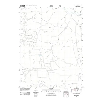
2011 Map of Eagle Rock
USGS Topo · Published 2011About this map
Baker Mountain and the prominent formation of Eagle Rock dominate this high-altitude landscape in Park County, where the terrain is etched by a complex network of gulches and seasonal drainages. Mineral exploration and outdoor recreation define the human footprint, evidenced by the Lucky Jim One Mine, Lucky Jim Two Mine, and Lucky Jim Three Mine complex in the southwest, and the Indian Mountain Ski Area to the northwest.
Find a feature on this map
63 named features on this map. Tap any name to fly to it.
Don’t see what you’re looking for? This feature index may not catch every label — zoom into the map to look around manually.
Map Details
Editions of this 2011 Eagle Rock Map
This is the sole edition of this map. No revisions or reprints were ever made.
Other maps of this area

1937 · Como
USGS Topo · 1:62,500

1953 · Denver
USGS Topo · 1:250,000

1956 · Eagle Rock
USGS Topo · 1:24,000

1956 · Elkhorn
USGS Topo · 1:24,000

1956 · Sulphur Mountain
USGS Topo · 1:24,000

1956 · Farnum Peak
USGS Topo · 1:24,000

1956 · Hartsel
USGS Topo · 1:24,000

1956 · Glentivar
USGS Topo · 1:24,000

1957 · Denver
USGS Topo · 1:250,000
1957 · Milligan Lakes
USGS Topo · 1:24,000