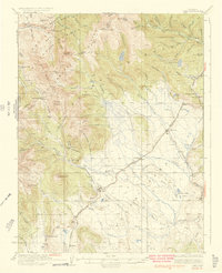
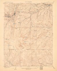
1937 Map of Como
USGS Topo · Published 1937About this map
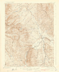
The Continental Divide winds through this high-altitude landscape of Park County, where the mining economy and early rail lines of the 1930s are clearly visible. The settlement of Como serves as a primary hub near the southern edge, connected by the rail lines that once navigated these steep passes. To the north, the industrial footprint of the gold and silver era is marked by features like the Wire Patch Mill and the Ute Mine, while small communities like Lincoln, Mineral Hill, and Farncomb Hill cluster near the gulches. High mountain crossings such as Boreas Pass and Kenosha Pass define the transport routes between the drainage of the Swan River and the North Fork South Platte River. This survey, updated in the mid-1930s, documents the intricate network of gulches and creeks, including Michigan Creek and French Creek, that shaped the region's development.
Find a feature on this map
84 named features on this map. Tap any name to fly to it.
Don’t see what you’re looking for? This feature index may not catch every label — zoom into the map to look around manually.
Map Details
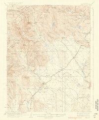
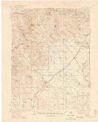
Editions of this 1937 Como Map
3 editions found
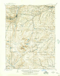
Other maps of this area

1889 · Leadville
USGS Topo · 1:125,000

1891 · Leadville
USGS Topo · 1:125,000
1903 · Georgetown
USGS Topo · 1:62,500
1905 · Georgetown
USGS Topo · 1:62,500
1924 · Montezuma
USGS Topo · 1:62,500

1926 · Montezuma
USGS Topo · 1:62,500
1929 · Dillon
USGS Topo · 1:62,500
1933 · Montezuma
USGS Topo · 1:62,500

1934 · Climax
USGS Topo · 1:48,000
1934 · Dillon
USGS Topo · 1:62,500