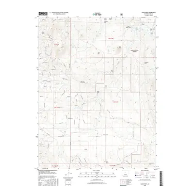
2016 Map of Eagle Rock
USGS Topo · Published 2016About this map
Eagle Rock and Baker Mtn dominate this central Colorado landscape within the Pike National Forest. This 2016 survey illustrates a high-altitude terrain defined by a network of gulches and draws, including West Fork Early Gulch, Steel Gulch, and the curiously named Schoolmarm Draw. Small clearings like Lux Field appear amidst the topographical contour lines, while water sources such as Berkey Spring, Harriman Spring, and Inbetween Spring are scattered across the drainage basins.
Find a feature on this map
108 named features on this map. Tap any name to fly to it.
Don’t see what you’re looking for? This feature index may not catch every label — zoom into the map to look around manually.
Map Details
Editions of this 2016 Eagle Rock Map
This is the sole edition of this map. No revisions or reprints were ever made.
Other maps of this area

1937 · Como
USGS Topo · 1:62,500

1953 · Denver
USGS Topo · 1:250,000

1956 · Eagle Rock
USGS Topo · 1:24,000

1956 · Elkhorn
USGS Topo · 1:24,000

1956 · Sulphur Mountain
USGS Topo · 1:24,000

1956 · Farnum Peak
USGS Topo · 1:24,000

1956 · Hartsel
USGS Topo · 1:24,000

1956 · Glentivar
USGS Topo · 1:24,000

1957 · Denver
USGS Topo · 1:250,000
1957 · Milligan Lakes
USGS Topo · 1:24,000