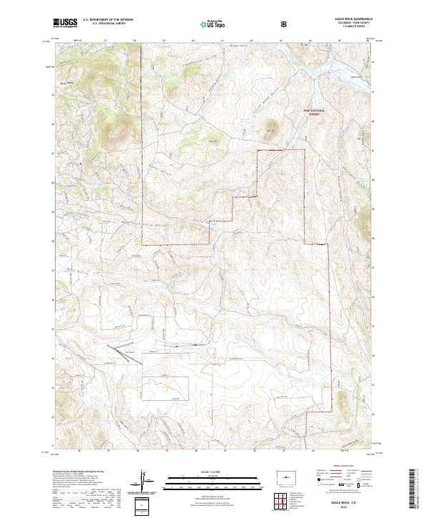
2022 Map of Eagle Rock
USGS Topo · Published 2022About this map
Pike National Forest dominates the high-altitude landscape of Park County, where the terrain is carved by complex drainages like Early Gulch and Little Baker Gulch. The Northeastern corner reveals an intricate water management system with Tarryall Cr feeding into the Holst Ditch 2 and Holst Packer Ditch. These diversions highlight the historical necessity of water rights and transport in this arid mountain environment, supporting local ranching and land use long before modern development.
Find a feature on this map
110 named features on this map. Tap any name to fly to it.
Don’t see what you’re looking for? This feature index may not catch every label — zoom into the map to look around manually.
Map Details
Editions of this 2022 Eagle Rock Map
This is the sole edition of this map. No revisions or reprints were ever made.
Other maps of this area

1937 · Como
USGS Topo · 1:62,500

1953 · Denver
USGS Topo · 1:250,000

1956 · Eagle Rock
USGS Topo · 1:24,000

1956 · Elkhorn
USGS Topo · 1:24,000

1956 · Sulphur Mountain
USGS Topo · 1:24,000

1956 · Farnum Peak
USGS Topo · 1:24,000

1956 · Hartsel
USGS Topo · 1:24,000

1956 · Glentivar
USGS Topo · 1:24,000

1957 · Denver
USGS Topo · 1:250,000
1957 · Milligan Lakes
USGS Topo · 1:24,000