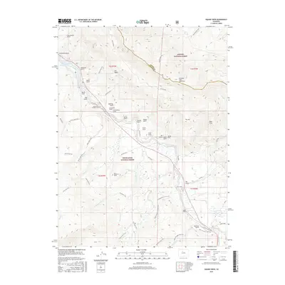
2016 Map of Eagle Roost
USGS Topo · Published 2016About this map
The Williams Fork Mountains dominate the high-altitude landscape of this Summit County and Grand County border region, captured during a period of extensive trail mapping. The Blue River valley serves as a central corridor, with its waters partially diverted into the Green Mountain Reservoir in the northwest. This area is a significant intersection of public lands, where the Arapaho National Forest meets the White River National Forest. Genealogists and local historians will find the Kansas Gulch Grandview Cem north of the river, near the Lonesome Gulch drainage. The map details a complex network of historic routes and access ways, including the Gore Range Trail, Ute Pass, and the Kirkwood Ditch Access Trail, reflecting the area's long history of ranching and mountain transit.
Find a feature on this map
62 named features on this map. Tap any name to fly to it.
Don’t see what you’re looking for? This feature index may not catch every label — zoom into the map to look around manually.
Map Details
Editions of this 2016 Eagle Roost Map
This is the sole edition of this map. No revisions or reprints were ever made.
Other maps of this area

1929 · Dillon
USGS Topo · 1:62,500

1933 · Mt. Powell
USGS Topo · 1:48,000

1933 · Ute Peak
USGS Topo · 1:62,500

1934 · Minturn
USGS Topo · 1:62,500

1934 · Dillon
USGS Topo · 1:62,500

1937 · Ute Peak
USGS Topo · 1:62,500

1940 · Mount Powell
USGS Topo · 1:62,500

1950 · Minturn
USGS Topo · 1:62,500

1957 · Leadville
USGS Topo · 1:250,000

1959 · Leadville
USGS Topo · 1:250,000