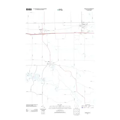
2013 Map of Earlville
USGS Topo · Published 2013About this map
Earlville and Delaware anchor the northern landscape of this Iowa survey, where the steady geometry of agricultural roads meets the winding courses of Plum Cr and Penn Cr. The region is defined by its transit corridors and rural townships, featuring the Tri-State Raceway situated between the two primary settlements. To the south, the terrain shifts significantly as it approaches the Maquoketa River and the waters of Hartwick Lake. This area surrounding Delhi reveals a more complex drainage pattern where Allison Cr joins the river system. The map serves as a precise record of contemporary Iowa land use, illustrating the transition from the high-speed racing grounds to the quiet riverbanks and local street grids like Main St and Virginia St.
Find a feature on this map
52 named features on this map. Tap any name to fly to it.
Don’t see what you’re looking for? This feature index may not catch every label — zoom into the map to look around manually.
Map Details
Editions of this 2013 Earlville Map
This is the sole edition of this map. No revisions or reprints were ever made.
Other maps of this area

1900 · Anamosa
USGS Topo · 1:125,000

1902 · Elkader
USGS Topo · 1:125,000

1959 · Dubuque
USGS Topo · 1:250,000

1961 · Dubuque
USGS Topo · 1:250,000

1962 · Dubuque
USGS Topo · 1:250,000

1962 · Petersburg
USGS Topo · 1:24,000

1965 · Thorpe
USGS Topo · 1:24,000
1965 · Dyersville West
USGS Topo · 1:24,000
1965 · Greeley
USGS Topo · 1:24,000

1966 · Hopkinton East
USGS Topo · 1:24,000