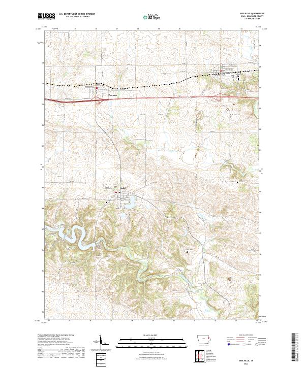
2022 Map of Earlville
USGS Topo · Published 2022About this map
The winding Maquoketa River and its many tributaries, including Allison Cr and Penn Cr, define the drainage and topography of this eastern Iowa landscape. This 2022 survey captures the distinct rural settlement patterns of Delaware County, centered on the communities of Earlville, Delhi, and Delaware. The map provides a detailed view of the regional road network, from established routes like Co HWY d5x to numerous numbered section-line roads such as 210th ST and 280th Ave.
Find a feature on this map
64 named features on this map. Tap any name to fly to it.
Don’t see what you’re looking for? This feature index may not catch every label — zoom into the map to look around manually.
Map Details
Editions of this 2022 Earlville Map
This is the sole edition of this map. No revisions or reprints were ever made.
Other maps of this area

1900 · Anamosa
USGS Topo · 1:125,000

1902 · Elkader
USGS Topo · 1:125,000

1959 · Dubuque
USGS Topo · 1:250,000

1961 · Dubuque
USGS Topo · 1:250,000

1962 · Dubuque
USGS Topo · 1:250,000

1962 · Petersburg
USGS Topo · 1:24,000

1965 · Thorpe
USGS Topo · 1:24,000
1965 · Dyersville West
USGS Topo · 1:24,000
1965 · Greeley
USGS Topo · 1:24,000

1966 · Hopkinton East
USGS Topo · 1:24,000