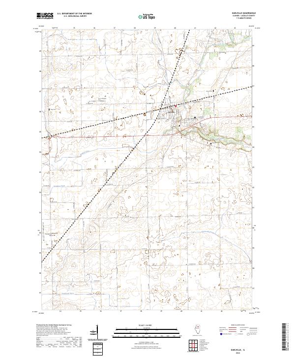
2024 Map of Earlville
USGS Topo · Published 2024About this map
The city of Earlville serves as the central hub of this LaSalle County landscape, where an orderly grid of country roads meets the winding path of Indian Creek. The area is marked by its aviation and burial history, featuring local landing strips like the B & C Airport and the Munglove/Otterbach Airport alongside several pioneer and community burial grounds. Genealogists can trace family heritage at Saint Theresa Cem, Precinct Cem, Carter Cem, and Tripp Cem, which are scattered across the surrounding agricultural reaches.
Find a feature on this map
51 named features on this map. Tap any name to fly to it.
Don’t see what you’re looking for? This feature index may not catch every label — zoom into the map to look around manually.
Map Details
Editions of this 2024 Earlville Map
This is the sole edition of this map. No revisions or reprints were ever made.
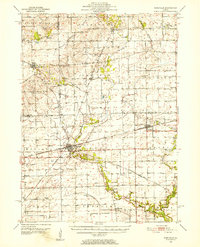
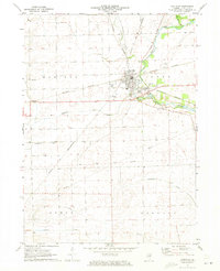
Historical Maps of Meriden Township Through Time
3 maps found