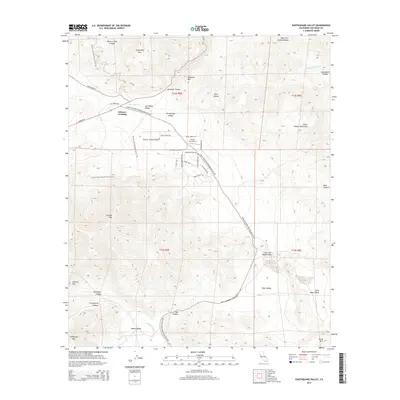
2015 Map of Earthquake Valley
USGS Topo · Published 2015About this map
The Great Southern Overland Rte of 1849 cuts a long diagonal through this high-desert landscape, following the floor of Earthquake Valley and Mason Valley. This historic transit corridor is marked by a concentration of evocative trail names near Scissors Crossing, including the Stage Coach Trl, Wells Fargo Trl, and Buckboard Trl. The intersection of these routes near Hunt's Sky Ranch illustrates how mid-19th-century pioneer paths became the foundation for modern regional connectivity.
Find a feature on this map
49 named features on this map. Tap any name to fly to it.
Don’t see what you’re looking for? This feature index may not catch every label — zoom into the map to look around manually.
Map Details
Editions of this 2015 Earthquake Valley Map
This is the sole edition of this map. No revisions or reprints were ever made.
Other maps of this area

1903 · Cuyamaca
USGS Topo · 1:125,000

1903 · Ramona
USGS Topo · 1:125,000

1904 · Southern California Sheet No. 2
USGS Topo · 1:250,000

1931 · Vallecito
USGS Topo · 1:125,000

1931 · Carrizo
USGS Topo · 1:125,000

1939 · Santa Ysabel
USGS Topo · 1:62,500

1939 · Borrego
USGS Topo · 1:62,500

1942 · Borego
USGS Topo · 1:62,500

1942 · Cuyapaipe
USGS Topo · 1:62,500

1942 · Cuyamaca Peak
USGS Topo · 1:62,500